Agriculture
November 9, 2023
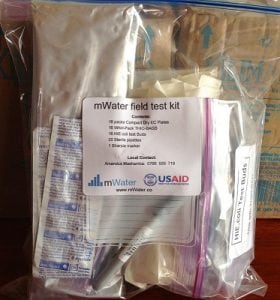
mWater Field Test Kit
Read SolutionImplemented by
mWater
Updated on November 9, 2023
·Created on July 7, 2017
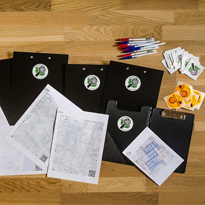
Field Papers is an open source tool built by Stamen Design to help users create a multi-page atlas of anywhere in the world.
Users can print it, take it into the field, and record notes and observations about the area. Later, the users can photograph each page in the atlas, and upload them back into Field Papers where a scan code geolocates the atlas so that the written data can be traced and then shared or downloaded.
Target Users (Target Impact Group)
Distributors / Implementing Organizations
Anyone who has a computer, internet access, and a printer can create an atlas and print it off. Visit the Field Papers website, make an atlas, make take notes and observations and upload the photo of your atlas.
Manufacturing/Building Method
Field Papers is built on Python, Javascript and Ruby on Rails. It utilizes Devise for managing users and Leaflet for it's interactive maps. More details available on their GitHub page
Intellectural Property Type
Open Source
User Provision Model
Users obtain the tool by accessing it online and downloading the resulting atlas and uploading the image with the notations.
Distributions to Date Status
The first version of Field Papers was launched in May 2012, in partnership with Caerus Associates. In June of 2013, Stamen Design relaunched the site in collaboration with the U.S. Agency for International Development (USAID) with major improvements to site performance, new metrics on atlas creation, as well as a general usability upgrade. There have been over 100,000 atlases created on the Field papers site.
Design Specifications
These photographs are called "snapshots" on the site. When a user uploads a snapshot, it's connected automatically to the atlas from whence it came. Users can transcribe any notes they made in the field into Field Papers (as points or areas) and share the results or download their notes for later analysis.
Technical Support
For step by step instructions for how to use Field Papers users can refer to the OpenStreetMap Wiki page Contributors or users can report bugs on their GitHub page
Replacement Components
Not Applicable
Lifecycle
Not Applicable
Manufacturer Specified Performance Parameters
Field Papers is designed to print out custom maps and enable users to capture data that has been collected in the field. The tool was designed to be easy to use, and compatible with OpenStreetMap and offline OpenStreetMap editors.
Vetted Performance Status
Over 100,000 atlases have been created on the site
Safety
Not applicable
Complementary Technical Systems
Academic Research and References
None
Compliance with regulations
Not applicable
Other Information
Agriculture
November 9, 2023
Implemented by
mWater
Agriculture
November 9, 2023
Agriculture
November 9, 2023

Agriculture
November 9, 2023
Agriculture
November 9, 2023

Agriculture
November 9, 2023
Agriculture
November 9, 2023
Agriculture
November 9, 2023
Agriculture
November 9, 2023

Agriculture
November 9, 2023
Have thoughts on how we can improve?
Give Us Feedback